OPEN SOURCE TOOLS
There are many wonderful open source tools for communities to engage with online to learn more about the land, animals and plants in our bioregion. Below is a list of some of our favorites - click on a title or image below to be taken directly to the tool, or you can click HERE to download a PDF list. Please stay tuned and sign up to our Newsletter, as we will be hosting a webinar series with respective agencies to offer step-by-step walkthroughs and explanations on how to get the most our of these tools. All webinars will be recorded and archived in our Bioregional Video Library.
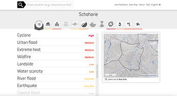
MAPS & INTERACTIVE TOOLS

Agency: New York State Department of Environmental Conservation
The Environmental Resource Mapper is an interactive mapping application that can be used to identify some of New York State's natural resources and environmental features that are state or federally protected, or of conservation concern.

Agency: New York State Department of Environmental Conservation
DECinfo Locator is an interactive map that lets you access DEC documents and public data about the environmental quality of specific sites in New York State, as well as outdoor recreation information. A tutorial on how to use the mapper can be viewed HERE.

Agency: New York State Department of Environmental Conservation
New York Nature Explorer is an online tool for finding out about the animals, plants and habitats in your neighborhood or in your area of interest. Users may choose a county, town, or watershed, or they may specify their own location on a map. They will then receive a list of the animals, plants, and significant natural communities that have been found there, as documented in databases maintained by NYS DEC.

Potential Environmental Justice Area PEJA Communities
Agency: New York State Department of Environmental Conservation
Data shows polygon locations of Potential Environmental Justice Areas.